The Challenge
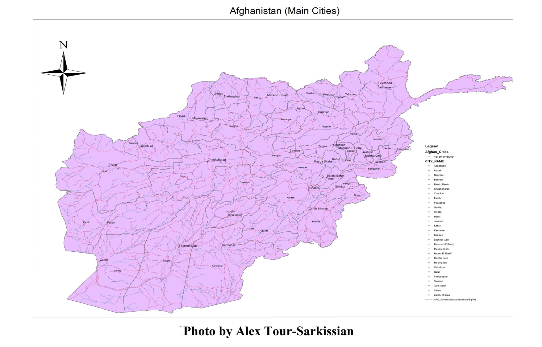
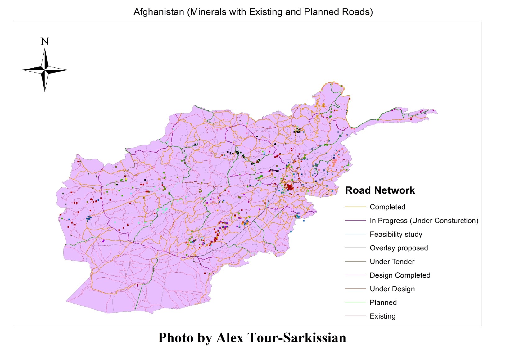
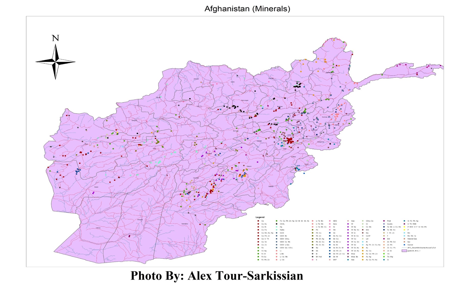
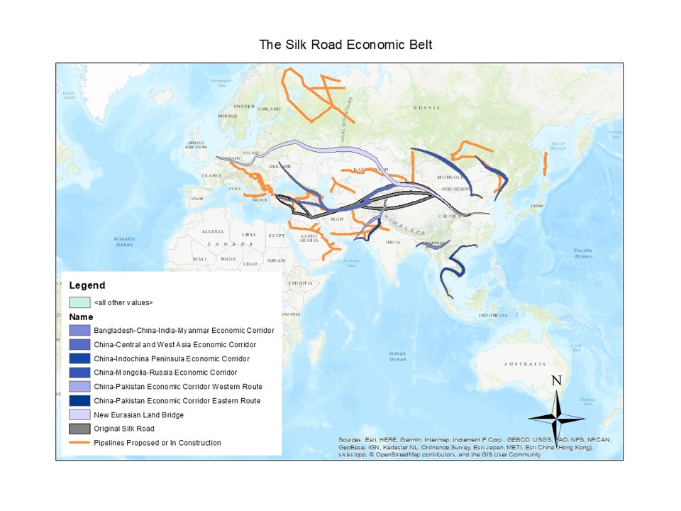
Geospatial intelligence analysis operates at the intersection of spatial methodology and strategic context. Over 13 months, four analytical GIS products were delivered supporting internal government research — mapping Afghanistan's mineral resource distribution, Belt and Road Initiative infrastructure corridors, and regional transportation networks across Central and South Asia. Each output addressed a specific spatial question about resource control, infrastructure access, and network connectivity in areas where reliable public datasets are incomplete or contested.
Work was executed under analyst direction: research requirements came in, spatial products went back out. The primary dataset — Belt and Road infrastructure — required integration into the GIS environment, spatial relationship analysis, and verification against regional basemap data before outputs were delivered. Rapid turnaround was required. Precision was not negotiable.
This engagement reinforced a transferable analytical discipline: understand the intelligence question before touching the data, structure the spatial framework to answer it directly, and produce outputs that hold up to internal review under time pressure. That discipline — applied consistently across four maps over 13 months — applies to any high-stakes GIS analyst role.
"Analytical GIS under operational pressure has one standard: the spatial output has to be defensible. Structure the data correctly, verify the output, and don't deliver until it holds up — that discipline carries across every domain."
Process
-
1
Research Reviewed analyst research requests; identified spatial scope and data requirements; sourced Belt and Road infrastructure dataset.
-
2
Data Prep Integrated infrastructure dataset into ArcGIS environment; verified spatial alignment with regional basemap data.
-
3
GIS Work Mapped mineral resource distribution, infrastructure corridors, and transportation networks; produced rapid-turnaround cartographic outputs.
-
4
Output 4 analytical maps delivered over 13 months; used for internal planning and research.
In high-stakes analytical work, the framework — what you're mapping, what question it answers, what counts as correct — must be established before any data is processed. This discipline was forged under conditions where imprecision had real consequences.